
The usual cadastre, like never before.
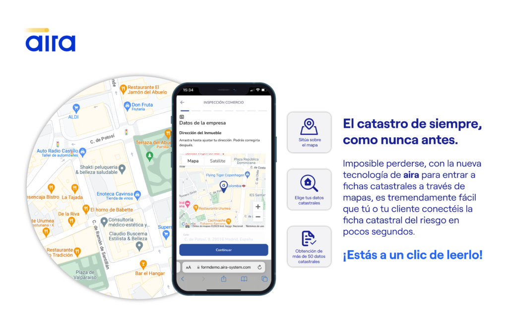
Impossible to get lost, with the new technology of air to enter cadastral files through maps, it is tremendously easy for you or your client to connect the cadastral risk file in a few seconds. We apply an existing technology, Google Maps, so that we geolocate the risk that we want to evaluate with the aira system and, in a few seconds, […]